 Secure Payment
 Free shipping on orders over €60 (UE)
 Financing on orders +60 €
 Hassle-free returns
Create your Waypoints database
The points of interest closest to your route
With the route done, now it's time to create a small database of points of interest in the area. In Land 9 we have no limit on the creation of waypoints, so we can mark as many points as we want. In addition, we can organize them freely by creating several collections of waypoints.
"What is a waypoint collection for?"
I'm sure that by now you're wondering. Marking points of interest near our routes can be useful for this and other excursions we make in the same area. For example, you can mark waypoints in locations that could be of great importance in case you need to take shelter due to a change in weather, or, if you have time, extend your excursion by visiting other locations outside the planned route. In this example, we are creating an easy route close to population centers, it is a route without major dangers. However, creating a good collection with reliable waypoints becomes more important on high mountain routes where having these locations identified can save you from a good scare in any risky situation.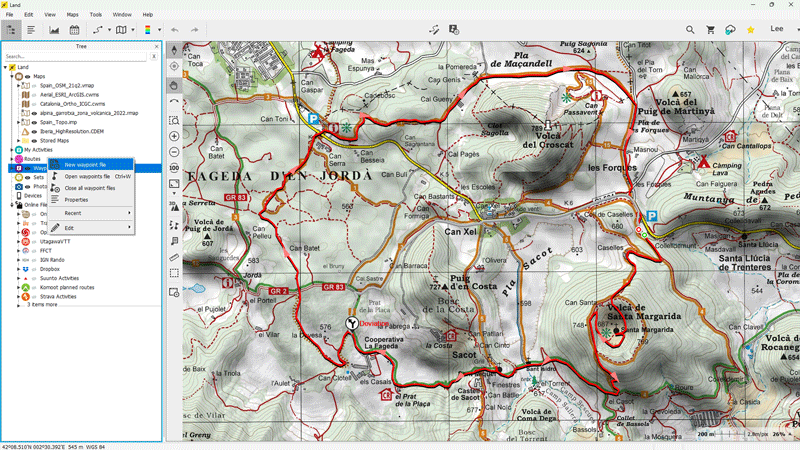
Create a Waypoint File
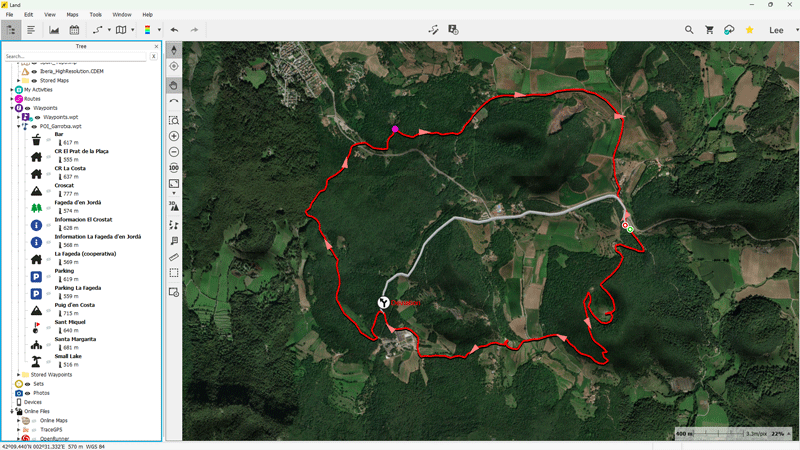
For this area, I will only create one waypoint collection although with the help of Land 9 we could create more than one, it all depends on how you want to organize the waypoints of the area you are going to explore. The first thing we need to do is create a new waypoint file from the data tree. This file will contain the individual waypoints that we consider important and that can add value to the outing.Create Waypoints
Creating waypoints is very easy, do it directly on the map. Right-click on the exact location of the place to highlight and press 'New > Create waypoint here'. Next, you can customize the point you just marked with a title, a brief description of the place, a representative icon, and much more. All these fields are optional, fill in the ones that will be most useful to you.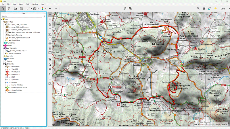
For this excursion, I have marked the following waypoints: parking, several hermitages, mountain peaks, information offices, and more. As we will see in the next chapter, these waypoints will serve us to enrich our route with valuable information that will allow us to transform it into a true navigation Roadbook.
Now it's your turn! If you need to see more examples, you can check out these videos where you'll see more practical cases of creating waypoints.
Mini-Tuts

Create a Waypoint
Measure distance between 2 waypoints
Would you like to continue receiving tips like these and more information about Land 9?
Yes, I want to stay informed
 Secure Payment
 Free shipping on orders over €60 (EU)
 Hassle-free returns